Welcome to
RM of Rosthern No. 403
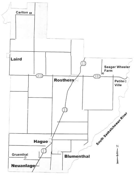
Map
R.M. of Rosthern maps are available for pick up at the office for only $17.50.
A copy of the map is also available on the app iHunter for a minimal fee.
Located just 35 kms north of the City of Saskatoon and stretching north to the North Saskatchewan River on the northwest and east to the South Saskatchewan River which serves as the eastern boundary. Highway #11, the provincial primary weight route between Saskatoon and Prince Albert, travels north through the Municipality and intersects with secondary highway #312 in the Municipality near Rosthern. Highway #312 takes you to the Seager Wheeler National Historic Farm, Petite Ville and Batoche, site of the NorthWest Rebellion. Just north of the Town of Rosthern, on Highway #11, the Valley Regional Park offers a 18 hole grass green golf course, serviced RV sites and a large playground and mini-golf.
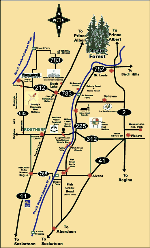
Tourism Map
You can download a copy of the map in PDF format for printing on your printer. The file is approximately 600kb and you will need a PDF reader such as the Adobe PDF Reader to open the file.
![]()
R.M. of Rosthern Office
1001 6th St.
P.O. Box 126
Rosthern, SK S0K 3R0